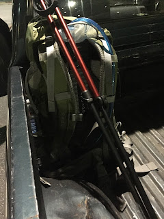
The starting point set in stone (literally) and the finish line a long way off. Forty miles to be real close. Using the AT guide book, maps and Guthooks App the details are added to the plan. Mountain elevations, distances, campsites and available water are planned out. All that remained was to set aside a few days to accomplish the journey.
A day off from work was requested and all was set. Friday 28th of October was to be the first day the trip ending Sunday October 31st, 2016. The alarm clock buzzed and the day began, a cuppa joe the pack placed in the truck and I hit the road. First stop was Wafflehouse for a substantial breakfast. The Thursday night halloween party crowd from the Electric Cowboy night club was ending their night as I began my day.
Sitting at the bar I ordered my usual: two eggs over medium an order sausage with grits and toast and a cuppa coffee to wind me up. My Saucony trail running shoes where about to go on the last trip of their career. They have served me well for somewhere close to 750 miles. Time to break out the Brooks Cascadia 10's and continue the hiking and trail running.
Next stop REI, drop off my truck for the next few days hop in my friends Dodge truck and drive up to Dicks Creek Gap near Hiawassee, Ga. in the Chattahoochee National Forest. Arriving just as the sun was rising we took a few photos and noted that campfires where prohibited due to the lack of rain during the last few months.
Starting our three day hike I noted that I been here a long time ago when I was a young man. Camping in this area of N. Georgia had always been something I enjoyed and dreamed of one day hiking the Appalachian Trail in-toto. Dropping into Cowart Gap re-enforced this memory and the good times of days past. Moving through Plumorchard Gap the Georgia North Carolina border was not far off. A selfie was in store and as you can see i am not the most talented selfie taker.
Georgia down North Carolina to go. We would soon be at Bly Gap and the iconic old gnarled tree would be waiting on us.
Evan and Courtney smiling for the old man and his camera. We continued on through Sassafrass Gap and past the Chunky Gal Trail to our end of day destination at Wateroak Gap.
We found a small flat area to the right of the marker at Wateroak Gap and set up camp. Water was not far off with a small spring providing fresh water for the filling of our water bottles and cooking needs. After eating dinner hanging my bear bag proved to be an exercise in comedy. Finally getting it up in a tree and the bear canister stowed away we settled in for the sunset and a good chat time before calling it a day. Just after dark a southbound hiker arrived and set up camp just the other side of the Gap.
After breakfast and packing our gear we readied for our first Appalachian Trail climb to over 5000'. Standing Indian Mountain . We approached Deep Gap crossed the dirt road and began our climb in earnest. At 5498' it was the highest peak of this section and the highest peak so far on the trail. At the top of the mountain was a Bear Sanctuary.
The sign had been there for many a year evidenced by the tree covering the upper portion of the sign. We took a short break and headed down to Beech Gap. As we traveled further we almost returned to Georgia. Up ahead was Betty Creek Gap where we spent our second night. Beside Mooney Branch. Here I soaked my feet in the cold water relieving some of the minor pain that had accumulated during the days hiking.
After breakfast and packing our equipment we started our journey to Albert Mountain. At 5250' Albert Mountain was the second mountain over 5000' on our journey. The climb up to the summit and fire tower proved to be quite a workout. The last section prior to the top was extremely steep and demanded the use of the hands to steady yourself. The fire tower was closed at the top bur we could climb most of the way and take in the incredible views.
Standing at the top of the mountain I photographed my feet at the USGS survey plaque.
Wandering round I found the remains of the old cabin that served the fire watch crews over the years. It proved the the remains of the outhouse.
We worked our way along a ridge line and onward to Glassmine Gap and the intersection of Long Branch Trail.
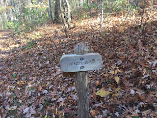
Through Rock Gap.
Onward through Wallace Gap.
In another hour or so we would be at the end of our journey.
Winding Stair Gap and the end was near.
To be continued...


