Sunday, February 28, 2016

Benton-Mackaye Out and Back

Friday 26 February 2016 thru Saturday 27 Feb 2016
Arrived at a windy and cold Springer Mountain parking area. I stepped out of the truck and immediately got back in and went through my pack for  my long pants, thermal vest and my beanie. Did I say it was cold? 26 degrees F and a stiff wind out of the northwest. I started the hike up to the summit and was chilled to the bone. Here are a few pictures of the cold and snow.


The walk to the summit was slippery at best and almost dangerous at worst. The wind was cutting through my clothes but I was layered well and onward I trudged. At the top of the mountain the wind really picked up and I was thinking of returning to the truck and try this another day. A few shots from the summit showing the trail marker and the sunrise.


As you can see it was beautiful on top of the mountain for the sunrise. After a few minutes it was time to move on. Down the trail a few hundred yards and passing the entrance to the shelter the Benton-Mackaye begins in earnest.


A little further on the plaque dedicating the trail came into view.


After a half mile or so there was a sign to an overlook, taking my time on this hike and documenting the hike I stopped to take in the view.


As you can see it was tremendous. Spending enough time admiring the scenery I moved on. Shortly crossing the road up to the summit the trail began to get regular and presented nice views all around too many to count. I crossed three creeks and lucked out with no wet feet to speak of which would have been quite miserable to deal with if not ending the hike.


 Finally crossing the Appalachian Trail for the first time I photographed the signpost.


Wandering onward the day brightened and my thoughts drifted to actually completing this hike.
After passing a large area of wild hog ruts I crossed the AT once again. Moving on I found a small cairn someone had started and placed a stone the dirty one on the left.


After some time the sound of a large rush of water was heard and the possibility of being near the three forks area grew in my mind. Here are the trail markers, white diamond indicates the Benton-Mackaye (BM) and the white rectangle indicates the Appalachian Trail (AT). The two markers indicate a joining of the two trails.


Just past the trail markers you are at the three forks area. There is a nice footbridge to cross the large creek here. Cross a forest service road and follow the markers up to Long Creek Falls.


One hundred and fifty steps and you are greeted with really nice view of the falls.


The falls could be heard for quite some distance and was worth the effort to see them. Here at the falls area the BM trail parts company with AT and heads to the Northwest. It was here that I ran into fellow hiker "slowlee" who was headed back to the main parking area after stopping at the Stover Creek Shelter. We parted company and I crossed two small snow covered bridges covered in snow and no hiker tracks indicating that I was headed into a remote area. The trail parallels a small creek and soon some small camping areas are passed. The trail took a decided uphill bent and I worked my way to a large "bald" area on top of one the few mountains that I would cross in the next few hours.

 I received a good cell phone signal and sent out a message to Alison and a picture to Facebook (FB). Crossing the bald I continued the up and down hiking known throughout the area. I failed to get water at a small stream and soon regretted it. Getting thirsty I realized that snow lay on the ground all around me. Grabbing some I allowed it to melt enjoying the cold and wetness. Bryson Gap came into view and the sign indicated a spring was located just to the East.

As I checked out the spring I noted that the area had a really nice camping spot and my time to stop as planned was running short. Deciding to call it a day I began to set up camp.

Just then I heard a clump up at the gap and began looking in that general direction and noted some legs moving around through the trees. I walked up to the gap and introduced myself to Andrew and chatted for a few minutes. He had been following my footsteps all day. The Benton-Mackaye trail is remote and does not attract near as many hikers as it's large cousin the Appalachian Trail. I returned to my camp and began writing in my journal recording the events of the day before the memories faded and you can read the results here. I boiled some water and fixed a hot cocoa and readied to eat my supper. The night came on and I settled in to my sleeping bag for a nights sleep. The new day broke crisp and cold and I got myself ready for a return hike to my truck at Springer Mountain. The return hike was uneventful Andrew was continuing onward for another few days. Getting back to the waterfalls area I ran into many hikers on the AT doing their thru hikes and some who where just hiking. Upon return to my truck I bumped into slowlee once again and he told me of a young man that had to be medevac'd out from Springer Mountain. He was having some life issues and was totally unprepared for the weather at the top of the mountain. I later talked with a forest ranger who confirmed the story. My thoughts go out to the young man and hope that all is well. I hope you enjoy these posts as much as do the hikes and the recording of the hikes. See you next hike. John...


Tuesday, February 2, 2016

Appalachian Trail maps section 1

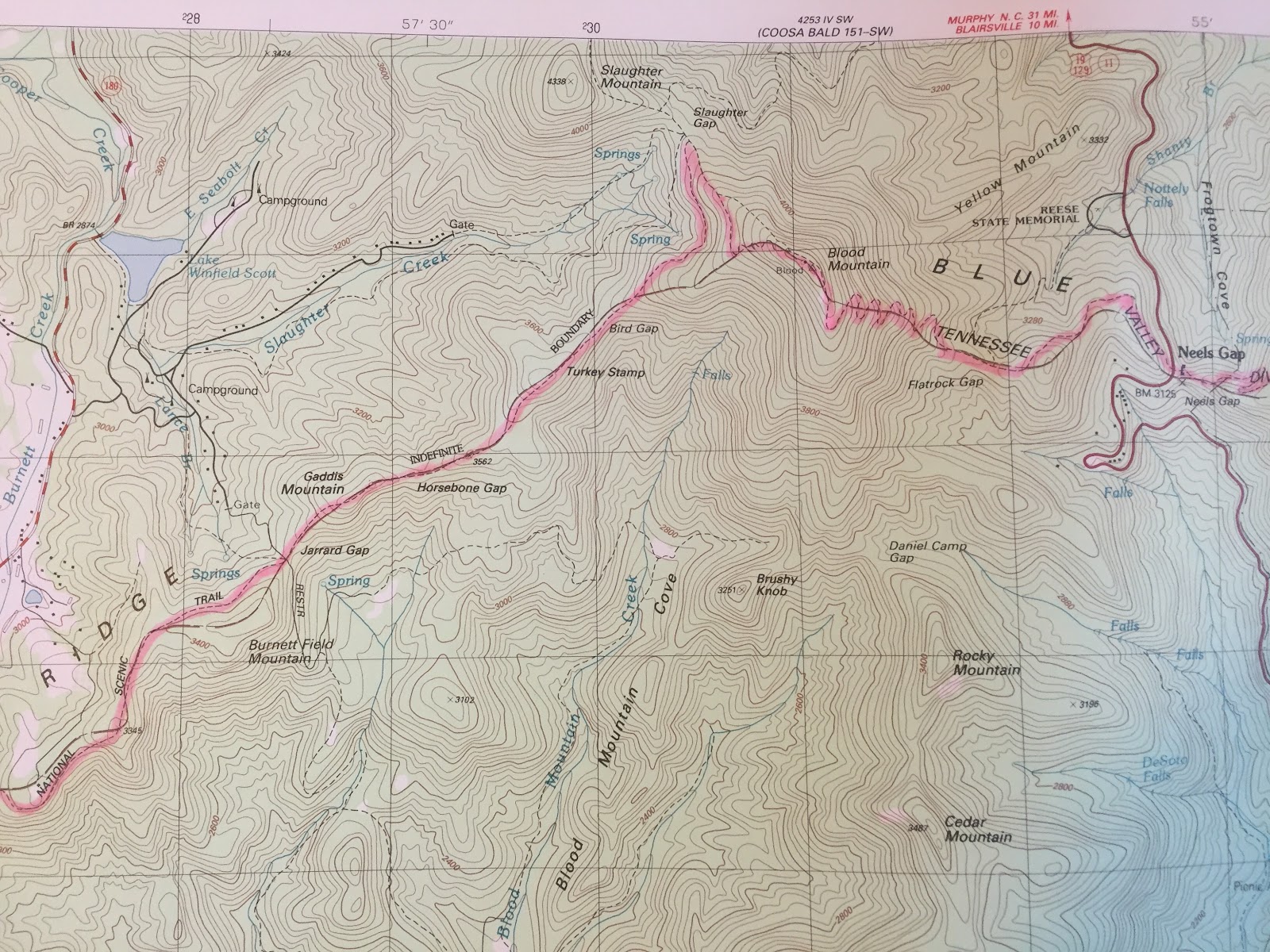
Hello all: Here are the maps that show Evan and my first section hike of the Appalachian Trail. Starting at Springer Mountain and continuing on to Neels Gap.

January 8-9, 2016. Here is the start of the trail in the lower left. After about a mile hike you cross a forest service road and continue to our first stop at the Stover Creek Shelter just a little ways prior to the creek crossing. We arrived at around 8 pm so it was quite dark. We settled in cooked some dinner and crashed. Evan awoke with a start a mouse had decided that his sleeping bag was a nice place to explore. Falling back asleep I was woke up by another mouse rummaging around my backpack. I hung the pack from a roof rafter and we enjoyed a little sleep until the cracking of dawn got us going. Breakfast and coffee got our motors running and the day began. The shelter had a system of wire pulleys set up to put your food out of reach and there was a composting privey set up.

January 9, 2016. Getting going at 8:30am the day promised to be nice but an evening of rain was forecast. Just after leaving the shelter the green tunnel began as we paralleled Stover Creek down to the three forks area. There is a footbridge here and a spacious campsite. We gathered some water in our filter bags and headed up beside long falls creek. Parting with the Benton Mackaye trail we headed east to the Hickory Flats area and onward to the Hawk Mountain Shelter. Departing the shelter area we ran into a SOBO hiker trail name "carpenter" who was set to end his thru hike tomorrow. January 10, 2016.Down thru Hightower Gap we pressed on, Gooch Mountain Shelter was our goal for the day. At 16 miles it was a nice hike. Passing through Horse Gap we stopped for a drink and a energy snack the wind and some rain cut our stop short.

Pressing on we headed for the Devils Kitchen area, the map indicated a footbridge but we found none. Evan was able to jump here and I thought the wiser and waded through. This was a bad decision my feet and shoes where wet and with a cold night ahead I was not looking forward to the next morning's start with wet/cold feet. We found Gooch Mountain Shelter stopped for a stretch/rest and promptly fell asleep only to be woken up by voices approaching. Four guys from Chattanooga we got up and got ready to cook some supper. We decided to get up extra early and hike in the dark to ensure that we did not arrive at Neels Gap to late for the long ride home. A little later another three guys from Ohio showed up and joined in cooking supper. We fell asleep to be woke up several times 
by the noise of the pouring rain.


January 10, 2016. We had agreed to get up early to get a head start on the day. Quickly packing and dressing we hit the trail at 4:30 am. The initial walk to Gooch Gap was easy, leaving the gap the trail became tricky and we found ourselves looking off in the distance at Dalonega, the trail dropped sharply to our right. It was here that I took a fall in the dark, my sleeping pad caught a rock threw me off balance and down I went bruising my knee and right hand. We continued on for some time watching the sun come up. We finally found a good stopping point and ate breakfast with a cup of coffee. Continuing on to Woody Gap the wind was picking up and the day got colder.


I took the lead here and set up a pretty good pace after a short while we heard an approaching hiker. It proved to a lady hike practicing for an upcoming through hike. I do not remember her trail name maybe Evan will and I'll update the post. She set up a fast pace and she slowly outpaced us. The wind picked up and we saw our first sign of snow and sleet. As we approached Blood Mountain the green 
tunnel began again.

The snow increased and the area was covered in a light coating of snow. Running into a SOBO hike from the Boston area we shortly arrived at the Blood Mountain Shelter and explored the area. The descent began and we met several day hikers who had their dogs in tow. Finally making it down to Neels Gap we stepped in the store and enjoyed a cup of coffee.
 The end of our first section hike.


Saturday, January 30, 2016

Kennesaw Mountain Hike

Saturday January 30, 2016. Noon, a bad time to go to the mountain with the wonderful weather. It looked like the park was packed the regular parking area and the overflow where overflowing. Oh, the humanity.

Kennesaw Mountain, just a short drive from my home and is almost visible from my front door. I had to park some distance from the park and walk in adding a few extra miles to my hike. Crossing Barrett Parkway I hiked a mile and a quarter to the park entrance. Putting it in gear I quickly climbed the mountain stopping at the summit to eat an energy bar and take a picture.

The weather was wonderful, take a look at that sky! Back in gear and down the mountain across the access road and over to the summit of Little Kennesaw Mountain. I was passed here for the first time by a runner in the rocky switchback area. The pace was good and I was almost running, 4+ miles per hour the smaller summit approached quickly.


The whole area is rock/boulder strewn and as indicated by the plaque an intense battle was faught here. Down the other side and Burnt Hickory Road soon came into view. A banana was scarfed down quickly followed by some cold water from a fountain. 


The walk over to Cheatham Hill and the Illinois Monument began. The trail here is gentle  with a few minor hills thrown in. Dallas Hiway was reached and the halfway point was close.


Cheatham Hill, Illinois Monument the halfway point.The return walk was uneventful with the exception of assisting a wrong way couple trying to find the main park parking area.


A quick picture of a bridge and creek and the return walk was began in earnest.
A wonderful day out 14 miles lotsa smiles and hello passed from person to person, all kinds of people old young all kinds of races black white asian hispanic middle eastern. All kinds of dogs in tow. Great to be out and about in this great nation of ours.
The End.


Saturday, January 23, 2016

Pinhoti trail, maps.

The Highpoint Trailhead and the initial climb up to Taylor Ridge.

Taylor Ridge.


Dropping into Mack-White Gap and continuing along Taylor Ridge.


Taylor Ridge dropping down into Hammonds Gap and the beginning of the long road walk. We passed a few farms and saw a coyote cross the road a hundred yards ahead of us. We also saw a dozen or so wild turkeys.


The end of the road hike and the beginning of the hike up Strawberry Mountain. End of day one a half mile or so after we reentered the forest. Day two began and we dropped into the West Amuchee Creek area. We saw deer sign and possible coyote scat along this section of trail. We began another road section here just after the creek crossing.


The end of the road hike here we reentered the woods down to East Armuchee Creek and the climb up Johns Mountain and the summit view, note the non highlited trail to the Keown Falls here we did not follow the highlighted trail until the Furnace Valley area on the next map.


We rejoined the trail at the lower point after hiking by Pilchers Pond. The slog up Fort Mountain began here. Note point 505, the summit with the cairn and the drop into Snake Creek Gap.
I hope you have enjoyed the journey.


Pinhoti trail day 2

Awakening at around 5 am we boiled some water and drank some delicious coffee a quick breakfast and it was time to break camp. Finishing our climb up and over Strawberry Mountain we dropped into the West Armuchee Creek area where we encountered some hunters who seemed to not be real happy with our appearance. We filled up with water at a nearby creek and got our feet throughly wet in the crossing of W. Armuchee Creek.


Another long road walk and we finally reentered the woods at the horse riding stables. The long slog up John's mountain began in earnest, (Photo).


Evan getting ready to don his backpack and cross East Armuchee Creek. After the long climb up John's mountain, this would be Evans second trip and my third. Twice on a mountain bike for me and once running for Evan. We decide to follow the forest road all the way to the top and check out the view of the forest below. We asked a couple to take our photo. All the exercise has yet to minimize my belly and the hip belt has exaggerated it. Lol...


We followed the trail from the summit down to the Keown falls. Areas of the trail had 
been damaged and we had to actually go under the falls.


We worked our way off the mountain and did a short road hop back into the woods near Pilchers Pond. It was here that my energy began to flag just as the long climb up Horn mountain began. My pace suffered greatly and the groans began in earnest. I pushed on and finally the last rock cairn came into view.


I bent down and tried to pick up a rock to place on the cairn and I was amazed as I watched my leg "shimmer". Hallucinations? I gathered my reserves and got the rock and placed on the cairn. We could almost see my truck off in the distance at the Snake Creek Gap trailhead. A long downhill was in front of us but the reward was not that far away. Driving to Evans car we stopped at a family style restaurant I gorged on a dinner of two pork chops baked sweet potato and a salad. Evan enjoyed a chicken dinner. We drove to the car loaded Evans pack exchanged thanks a hearty handshake and we both headed home. Just after leaving the parking area we ran into rain, just showing how close we came to having a two day hike in the rain.
The mileage varied, 42 by the maps my gps said 43 and my pedometer said close to 46. It was a great hike and our friendship grew tremendously, trust in one another and knowing that no matter what we had each other's back was a great feeling. The next page will be a series of maps showing the route with the exception of the hike by the Keown Falls. Enjoy!


Saturday, January 16, 2016

Official day 2 AT

It was dark as Evan woke me up. 4am as we had agreed. Up and out of the shelter ahead of the sleeping crowd. We had figured to be at my truck by 1pm. Ready by 4:30 we gathered our supplies hanging from the cables in the trees. It is wise being in bear country to stow your food off the ground and at distance from where you sleep.Appalachian trail safety
Evan had his headlight on and mine was in hand, headband and ratchet mechanism having failed during Friday nights initial walk in. We had at least 3 hours of walking in the dark, caution was the word. Rocks and roots everywhere ready to catch an unsuspecting footfall. All went well until about two hours in I took a tumble. Sleeping pad catching a overhanging rock and down I went. Bruising my knee and scraping my wrist, mostly my ego though. The sky began to lighten and morning hunger pangs began to remind us that we had no breakfast and coffee. Passing a mountain stream we stopped and fixed breakfast and coffee, the day's was beginning to turn colder, hot oatmeal and coffee where really welcome. Later we stopped and a lady hiker approached and we chatted for a few she was from North Carolina and doing some section hiking (breaking the trail into manageable chunks) preparing for a thru hike (doing the entire AT) https://en.m.wikipedia.org/wiki/Appalachian_Trail all approximately 2200 miles of it. Continuing onward we started to notice light sleet and snow at higher elevations. As began our assent of Blood mountain the cold increased and so did the amount of snow/sleet.

As witnessed here, Rhine frost was present showing the direction of the blowing sleet. The snow began to gather on the ground and the real assent began in earnest.


We passed several people on the trail headed south bound with a pleasent hello. Passing the Freeman trail we continued upward. Here we passed a young man who was traveling light and was about to finish his SOBO, he was from Boston, Massachusetts. Passing through an area of Rhododendrons we saw the Blood Mountain Shelter.
This is the oldest shelter on the entire AT, constructed of rock it would be a very cold place to stay. We explored the area for a few minutes and began our decent to Neels Gap. After seemed a very long 2 miles the gap came into view. Entering the store we obtained a cup of coffee and chatted with the salesman. Leaving the store we walked the short distance to my truck and started our journey back to Springer mountain and Evans car. Stopping at the Roadkill Cafe we some BBQ sweet potato fries and a mug of coffee. We drove through Dalonega and up to the parking area. As we approached the parking area the whole area was white with hoar frost.


Exchanging some pleasentries we departed Evan leading the way back home. He stopped a few hundred yards and stated that it appeared his rear brakes were frozen, we investigated and found the left rear was stuck on after some prying we was able to continue our way home.
The end...


Friday, January 15, 2016

Official day 1 AT

As the sky began to break in the East we prepared breakfast. Oatmeal with snickers snack size bars and a cup of pour through coffee. Pack the backpack and let the day begin. Here is a video link to show some of the trail in Georgia. The first ten minutes are a highlight of our 32 mile hike from Springer Mtn. to Neels Gap. https://www.youtube.com/watch?v=_iZd07QuvYw
A short walk and you arrive at Three Forks the  joining of Stover and Chester creeks forming the Noontoola creek.

Looking south along the Noontoola creek the area is lush with ferns and Rhododendrons.


Crossing the Noontoola creek.
Here you cross the forest service road 58 and begin a long uphill section paralleling the Long Creek. Off to the left is the Long Creek falls we saw glimpses and heard the roar of the water. The creek is home to a trout stream. Here we made a minor mistake that resulted in a half mile back track. The AT is intermingled with the Benton MacKaye trail. (BMT) in https://en.m.wikipedia.org/wiki/Benton_MacKaye_Trail
We saw a white diamond slash mark but no white rectangle slash mark panicked and retraced our steps only to discover our error and a return up the hill to continue our journey. Shortly the BMT heads out on it's own way.
After a few miles we came to the abandoned community of Hickory Flats there is an old graveyard and a plaque indicating the location of the old school.


We hiked onward through some rocky and root strewn sections past the hawk mountain shelter at the 8 mile mark. Shortly thereafter the trail became easier and here we met "carpenter" from New Hampshire. We chatted for several minutes discovering that he was about to finish his SOBO tomorrow. We departed and headed for the Devil's Kitchen and Justus Creek. It was here that I got my feet wet for the first and only time of our two day trip. Evan was able to jump at a relatively narrow spot, thinking of the consequences of my age and ability to jump I choose to just ford the creek and avoid a serious situation if I was to fall in. A little embarrassment is the better part of getting soaked in 40 degree weather. We continued on our way and finished our day at Gooch Mountain Shelter. Settling in Evan refilled our water containers we climbed up to the second level decide that we should stay at the shelter instead of pushing on for a few more hours and promptly fell asleep only to be woken up by voices approaching the shelter. Four guys from Chattanooga, Tennessee. A little after dark was setting in three other young guys from Ohio joined us. We cooked supper and readied for the day ahead of us. Evan and myself planned an early start for the next day. Around 7:30 the sky's opened up and rain began in earnest it continued through the night and was very heavy at times. We awoke very glad to had stayed at the shelter. We awoke at 4 am packed up and began our final day in the dark and facing a day that was to get colder as the day wore on.
To be continued...