Tuesday, November 8, 2016

AT Dicks Creek Gap to Winding Stair Gap

It all began with a plan! Some months ago a plan was formulated to continue the discovery of the Appalachian Trail.

The starting point set in stone (literally) and the finish line a long way off. Forty miles to be real close. Using the AT guide book, maps and Guthooks App the details are added to the plan. Mountain elevations, distances, campsites and available water are planned out. All that remained was to set aside a few days to accomplish the journey.
A day off from work was requested and all was set. Friday 28th of October was to be the first day the trip ending Sunday October 31st, 2016. The alarm clock buzzed and the day began, a cuppa joe the pack placed in the truck and I hit the road. First stop was Wafflehouse for a substantial breakfast. The Thursday night halloween party crowd from the Electric Cowboy night club was ending their night as I began my day.

Sitting at the bar I ordered my usual: two eggs over medium an order sausage with grits and toast and a cuppa coffee to wind me up. My Saucony trail running shoes where about to go on the last trip of their career. They have served me well for somewhere close to 750 miles. Time to break out the Brooks Cascadia 10's and continue the hiking and trail running.


Next stop REI, drop off my truck for the next few days hop in my friends Dodge truck and drive up to Dicks Creek Gap near Hiawassee, Ga. in the Chattahoochee National Forest. Arriving just as the sun was rising we took a few photos and noted that campfires where prohibited due to the lack of rain during the last few months.


Starting our three day hike I noted that I been here a long time ago when I was a young man. Camping in this area of N. Georgia had always been something I enjoyed and dreamed of one day hiking the Appalachian Trail in-toto. Dropping into Cowart Gap re-enforced this memory and the good times of days past. Moving through Plumorchard Gap the Georgia North Carolina border was not far off. A selfie was in store and as you can see i am not the most talented selfie taker.


Georgia down North Carolina to go. We would soon be at Bly Gap and the iconic old gnarled tree would be waiting on us.


Evan and Courtney smiling for the old man and his camera. We continued on through Sassafrass Gap and past the Chunky Gal Trail to our end of day destination at Wateroak Gap.


 We found a small flat area to the right of the marker at Wateroak Gap and set up camp. Water was not far off with a small spring providing fresh water for the filling of our water bottles and cooking needs. After eating dinner hanging my bear bag proved to be an exercise in comedy. Finally getting it up in a tree and the bear canister stowed away we settled in for the sunset and a good chat time before calling it a day. Just after dark a southbound hiker arrived and set up camp just the other side of the Gap.


After breakfast and packing our gear we readied for our first Appalachian Trail climb to over 5000'. Standing Indian Mountain . We approached Deep Gap crossed the dirt road and began our climb in earnest. At 5498' it was the highest peak of this section and the highest peak so far on the trail. At the top of the mountain was a Bear Sanctuary.


The sign had been there for many a year evidenced by the tree covering the upper portion of the sign. We took a short break and headed down to Beech Gap. As we traveled further we almost returned to Georgia. Up ahead was Betty Creek Gap where we spent our second night. Beside Mooney Branch. Here I soaked my feet in the cold water relieving some of the minor pain that had accumulated during the days hiking.


After breakfast and packing our equipment we started our journey to Albert Mountain. At 5250' Albert Mountain was the second mountain over 5000' on our journey. The climb up to the summit and fire tower proved to be quite a workout. The last section prior to the top was extremely steep and demanded the use of the hands to steady yourself. The fire tower was closed at the top bur we could climb most of the way and take in the incredible views.


Standing at the top of the mountain I photographed my feet at the USGS survey plaque.


Wandering round I found the remains of the old cabin that served the fire watch crews over the years. It proved the the remains of the outhouse.


We worked our way along a ridge line and onward to Glassmine Gap and the intersection of Long Branch Trail.


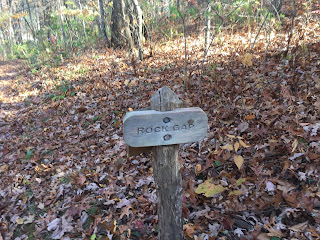
Through Rock Gap.


Onward through Wallace Gap.


In another hour or so we would be at the end of our journey.


Winding Stair Gap and the end was near.
To be continued...


Saturday, April 9, 2016

My Gear

Hello all: Here is my obligatory gear list. The gear I have been carrying is in a constant state of flux. Needs and situations change so the gear that I carry changes. I'll start with the big three, that is the Backpack, Tent and sleeping bag.

This is my Osprey Kestrel 38 liter backpack.
If you look closely at the center of the pack just above the white "Osprey" you can see the hole chewed into the pack by the mice during my first outing on the AT. The pack is fairly light and is pretty good for three days/two nights camping anything longer would really put the pack at a disadvantage. This pack will be Alison's pack when we begin to camp together.

This is my expanded pack a Osprey EXOS 58 liter.
This pack will allow me to extend my hiking into the 3/4 day 3/4 night range maybe longer! I have yet to use the pack if my Kestrel is any indication I should like this pack. 


This is my tent in a cuban fiber dry bag. I strap the tent and my sleeping pad to the outside of my pack to gain some internal storage space. The tent is a Six Moon Designs Lunar Solo LE
It weighs in at just under 2 lbs and is easy to set up using one of my trekking poles.

Here is my sleeping bag folded for ease of photography. It is an REI Lumen 25.
The bag is rated to 25 deg F and with the use of thermal underwear it can be pushed to colder temps. I may get a thermal liner in the future to push the cold temp rating even further into blue!


This is a tyvek ground cover sheet it is virtually puncture resistant and impermeable to water. It is placed on the ground under the tent.


Here is my sleeping pad that goes under my sleeping bag providing some comfort. 
I store it in a cuban fiber waterproof bag outside my main pack.


Here is my cooking system, a Jetboil Flash.
It is all apart and fits inside the unit at the top of the picture, the actual cooking unit, a fuel canister, the burner assembly, top cover, fuel canister tripod stand and the bottom cover. The small fuel canister has served me so far, the burner has a pizeo striker to ignite the burner.


This is my insulated drinking mug
Coffee, hot chocolate ect... Lightweight hangs on the outside via a small caribiner. Usually is filled with a few small items.


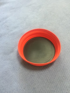
Eating bowl, it collapses flat for easy storage. Sea to Summit xl folding bowl.


This is the one luxury item that I carry. A pour through coffee filter holder. A good cuppa joe is what I consider a necessity. I pack enough fresh coffee grounds for the planned journey a small amount of sugar and dried milk. It also hangs on the outside via a small caribiner.


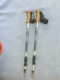
Trekking poles. REI traverse.
Poles really help with the walking over rocks and roots they have more than once caught me and stopped a fall. 


Rain poncho, this is a "real poncho, not a sears poncho" Froggtoggs.
Ultra lite weight and inexpensive, only used it once, to keep the cold wind off me while awaiting partner gathering water.


Hiking long pants, generally I wear shorts. Only in the extreme cold do these come out.
Lite weight and very comfortable.


My hiking footwear, trail runners. Saucony Xodus. Lite weight and some what waterproof. They feature a rugged sole for extra grip and wear. They have close to 250 miles on them at this point, and I have to report that no blisters formed during those miles.
This is as close to my shoes as I can find they are the current replacement version. I will probably get these or a pair of Brooks when replacement approaches.


Swiftwick socks protect my feet in the trail runners they dry quickly and minimize the chaffing thus preventing blisters. I also carry a pair of marino wool socks when the cold weather dictates.

I'll end here and update the rest of my gear, clothes and food items ect..


Wednesday, March 30, 2016

Appalachian Trail Maps Section 2

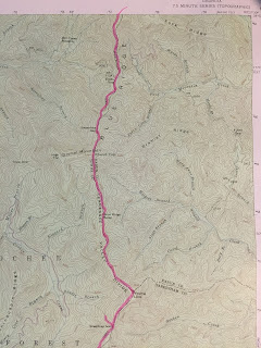
Hello everyone: I hope this finds you healthy wealthy and wise. A quiet evening at home a good time to work on the blog. Alison worked all day and has to go back in at midnight. The first map is showing the initial parking area ( Reece Memorial Park ), Neels-Gap and the first few miles of the trail. Evan thought we had stayed at Wolf Laurel Top and I believed we had stopped at Baggs Creek Gap ( Next Map ) figuring the miles we had walked. After reviewing the map I have come to believe that we actually had stayed at Wolf Laurel Top.

 The walk in was not bad some uphill sections initially then the trail leveled and ran along a ridge-line. That first campsite was really nice grassed in and a great view to boot.


We awoke the next day and started to break camp and cook some breakfast ( Oatmeal and coffee ) as some early birds passed the campsite. Readying ourselves we set out on our first day with a goal of a little over 20 miles and to end the day at the cheese factory site. Dropping into Stewart Branch Spring we filled our water situation. Setting off again we dropped into Tesnatee Gap where we shed some clothes for the upcoming heat of the day. Up and over and down into Hogpen Gap we are followed by some hikers, one of whom I nicknamed Gandalf because of the wooden staff he was using.  We had passed wildcat Mountain and the Whitley Gap Trail which lead to the Whitley Gap Shelter and a fresh water spring. I believe at Hogpen Gap we saw four ladies hiking that looked liked they where being resupplied. Items all laid out to be packed away. Up and over Wolfpen Stamp and onward to Strawberry Top down into Sapling Gap and over to Poor Mountain. Here we enter the next map.


Hiking along a ridge-line we passed numerous spots with names such as Wide Gap, Sheep Rock Top, Low Gap and Poplar Stomp Gap.


Passing Horsetrough Mountain we worked our way over to Chattahoochie Gap and in a few miles we would go over our first 4000 ft mountain ( Blue Mtn).


After Blue Mtn we dropped into Unicoi Gap I checked my foot for a possible hot-spot readied for some more miles to the Cheese Factory Site. Crossing over Indian Grave Gap we had a mile to go to the Cheese Factory ( little triangle above the D in Blue "Ridge" ). Here we stopped at another great little camp site I was so tired here that I set up my tent and bid Evan Adieu without eating. We awoke refreshed and a little sore but ready to go and rendezvous with Courtney and Olline. Breakfast fixed and coffee drank we readied for our next major mountain ( Tray Mtn ) the highest summit of this journey. The top of Tray was covered with Rhododendrons with the exception of a small area of bare rock. Coming off Tray mountain headed downward past the shelter. Through Wolfpen and Steeltrap gaps we pressed on toward Sassafras gap.


We passed Young Lick and continued onward toward the Swag of the Blueridge. It is a fairly level section of the trail covering some 4 or 5 miles. Over Round Top and down into Sassafras Gap. We stopped here and Evan took off and obtained water for the both of us. I slipped out of my backpack and took up residence at the base of a large oak tree. Stopping after a strenuous hike is a cooling afair, I covered up in my rain poncho ate a snack and awaited Evans return. We picked up some stray trash ( actually a small hip flask that smelled of Bourbon ) and headed toward our rendezvous with the ladies. Over and down into Addis Gap and upward to Kelly Knob ( 4130 ft ) the fourth of the 4000 ft mountains of the hike. This was quite possibly toughest section the AT so far. Dropping down into Deep Gap we met up with the ladies getting back into gear after a short chat we headed up to Wolfstake Knob and Powell Mtn the end was beginning to close in on us.


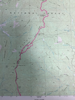
As you can see by this last map Dicks Creek Gap was close at hand. A group of hikers had gathered at the picnic spot located at the parking area. We hopped into Courtney's truck and headed home via a good burger joint. The next section is quite long at 40 miles and will probably take 3 days to complete. Dicks Creek Gap over to Franklin in North Carolina. Look forward to hearing your comments on the blog so far. John... 


Wednesday, March 23, 2016

Appalachian Trail 2

Hello all: The second section of the AT finally came around Evan and myself did the Neels Gap to Dicks Creek Gap this past weekend March 17-18-19 2016. We left work Thursday afternoon and drove up to Neels Gap to begin our hike.

Here is Evan looking ready to go. This is at the Waleski-Y center located at the Neels Gap trailhead, the center is a well known outfitter along the AT. I obtained some fresh water and we began our scheduled 38 mile hike. Stopping early we got some more water at a small spring and chatted with a few thru hikers at the spring. Continuing on our way the sun began to set we passed a few nice campsites and finally found an ideal campsite. Dark was coming on strong so we quickly set up camp cooked some food and got ready to call it a night.

Here is a shot of the sunset that ended our first short hike. We had gone close to 4 1/2 miles and stopped near our planned stopping point. Quickly falling asleep. We awoke early enough to be greeted by a most wonderful sunrise, there was a chill in air which made the sunrise all the more wonderful. 

Looking to the east and out over the valley this was the start to our real first full day on the trail.

The sun is up and here is a picture of the small camping area we occupied last night. Baggs Creek Gap. After some oatmeal and coffee we packed our gear and set out on the trail. A few hikers had already beat us to the start of the day and we followed suite. After a short walk we stopped at a spring and replenished our water supply. A few of the earlier hikers had gathered here to eat some breakfast and get a supply of water. Crossing Cowrock mountain we headed down into Hogpen Gap. 

Crossing Hogpen Gap we climbed up Poor Mountain and took a short break where I got this great picture of Evan enjoying the early day. Looking off in the distance we could see some smoke, sign of a small forest fire or a prescribed burn by the forest service.

We moved onward a through some areas with very interesting names like: Sheep Rock Top, Poplar Stamp Gap and Cold Springs Gap.
 

Here I am looking like the intrepid explorer at what we called ski slope rock a quick forty foot drop followed by a steep decent of probably a half mile or so to the bottom of the valley.


Here's Evan on the ski slope rock.

 We passed Chattahoochee Gap.

The very beginning of the Chattahoochee River. It is no more than a small spring and creek in the distance behind the sign. Travelling onward we approached Blue Mountain (4025 ft) the first of four peaks of over 4000 feet. Crossing the mountain we dropped down into Unicoi Gap.


Semi mumbling of a hot spot possible blister on my foot we stopped and I took off my shoe but nothing to be noted we carried on. Obligated to meet up with Courtney and Evans mom the next day.  Having carried trash most of the day we asked a young couple if they would dispose of said trash and they gladly obliged. Headed up hill we crossed Rocky Mountain (4017 ft) the second of the 4000 ft peaks. 


Dropping down into Indian Grave Gap the exhaustion was beginning to come on strong. Chatting with some campers we heard that rain and possible storms where due in the area at 2 am. We also discovered that our daily goal of stopping at the Cheese Factory Site was just a mile away. Pulling myself together I trudged onward following behind Evan. We arrived just as darkness was falling. I was so tired that I did not feel like eating and set up camp and fell asleep. About 1 am strong winds rattled the camp and thinking storms were not far behind I readied for a light show and rain. Breaking camp before the dark lifted Evan snapped a picture of me rolling up my sleeping pad.


After eating some breakfast and coffee we started our second day. Not far in front of us was the tallest of the four peaks, Tray Mountain (4430 ft). 


After crossing the summit we entered an area of the green tunnel and snapped a quick picture of Evan. As we moved onward the going got tougher and quite rocky. At times it was very rough going.


Here you can see me coming off the mountain and down through a particular rough area of rocks. A wrong step would have been a disaster and constant attention was demanded. Passing Tray Mtn. shelter we dropped down into the Swag of the Blue Ridge and headed to Sassafrass Gap. Here we got some water and a little needed rest. Here is an interesting tree Evan photographed.


The base was hollow but the tree was alive and quite large. Pressing onward we climbed the last of the 4000 ft peaks, Kelly Knob (4276 ft). On the downward slope we met up with Courtney and Olline. Moving onward we approached Deep Gap Shelter and shortly thereafter McClure Gap. Powell Mountain was in front of us and the end was almost in sight. Just after crossing the summit I made a hello statement to a young man out on a day hike. He said that a young couple up ahead said that we, Olline and myself should get it in gear and hurry up. Oh, yeah I thought. We caught up up with the above listed "young couple" and let them know that we had heard about their antics. We all had a good laugh and carried onward,  Evan snapped a selfie group picture as we readied to drop into Moreland Gap.


Evan, Courtney, myself and Olline bringing up the back. Moreland Gap was passed and we soon was in sight of Dicks Creek Gap. Courtney's truck was a welcome sight. Relieved myself of the backpack we prepared for the ride to my truck at Neels Gap. Stopping at a burger joint, Yonah Burger, I devoured a cheese burger fries and sweet tea, make that two sweet teas. The drive to my truck was uneventful and we parted our ways.